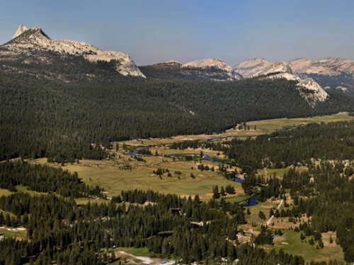
Tuolumne Meadows, located at 8500 ft in Yosemite National Park, is an iconic example of a high-elevation Sierra Nevada meadow system. Part of the headwaters of the Tuolumne River watershed, the broad U-shaped valley is surrounded by granitic domes and peaks shaped by past glacial processes. The Tuolumne River winds through the meadow complex, fed by snowmelt from permanent snowfields on Mt. Dana and Mt. Lyell. This virtual hike takes you along the Tuolumne River through the main Tuolumne Meadow complex. The hike begins on top of Lembert Dome, with a view overlooking the meadow complex. From there you can jump down to the hike along the river, which starts at stop 1 upstream of the Highway 120 and extends for approximately 3 miles downstream to the base of the meadow at stop 49. An interpretive trail with informative videos that are based on the real interpretive trail signs located in the park can be found between stops 10 and 24. Click on the link below to begin.
The hike may take several minutes to load depending on your internet connection. If you see a black screen or a pixelated view, please be patient, the tour will load within several minutes.
