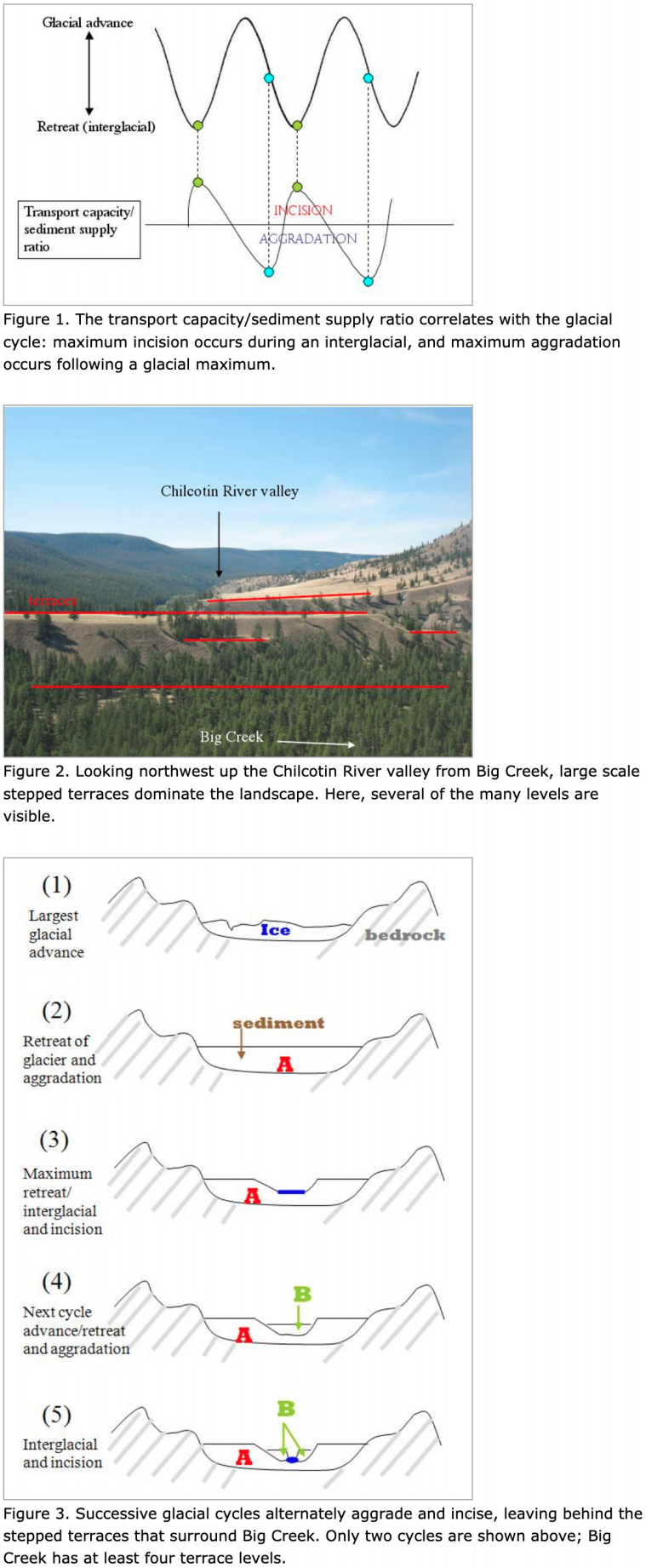
The geomorphology of a river system determines to a large extent its ecology: how and where vegetation can grow, the quality of fish habitat, flow conditions and water quality for insect survival. Big Creek's geomorphic history tells the story of a glacierdominated landscape and cyclical climate change. On both sides of Big Creek, strikingly flat stair-stepped terraces rise hundreds of feet above the present-day channel. These terraces were constructed and incised in stages over the past 25,000 years and are composed of entirely glacially-derived sediment.
In a glacial system, the geomorphology of fluvial landscapes is essentially determined by the relationship between the amount of available sediment and the ability of glacial runoff and precipitation to move the sediment. This can be estimated with the ratio of transport capacity to sediment supply (Figure 1). When this ratio is less than one, or sediment supply exceeds transport capacity, sediment accumulates, or aggrades, in river channels. When the ratio is greater than one and transport capacity is greater than the amount of available sediment, incision takes place, and the river cuts down into the surrounding rock. When the supply/transport ratio is one, the fluvial system is roughly in equilibrium, and neither significant aggradation nor incision occurs.
Since the late Pleistocene, there has been a net retreat of glaciers in British Columbia and worldwide. This retreat has not occurred smoothly: smaller cycles of glacial advance and retreat have dominated the past 25,000 years and left behind the terraces that define Big Creek's landscape.
In order to form, glaciers require sufficient precipitation and sufficiently low temperatures. During maximum glacial advance, precipitation ensures a moderate supply of water for sediment transport, and the grinding of glaciers on the surrounding rock provides ample sediment. The result is a moderate amount of aggradation in surrounding fluvial systems. As the glacier begins to recede, more sediment is released by the melting ice than can be transported by the meltwater. Maximum aggradation occurs midway through glacial retreat, and sediment can fill entire valleys. The tops of these deposits are flat floodplain surfaces that create today's flat-topped terraces (Figure 2).
When glacial retreat reaches a maximum during an interglacial period (such as today), the ratio shifts and high relative transport capacity causes incision into the thick aggradational layers. Maximum incision occurs at the point of maximum glacial retreat. Today's interglacial conditions have resulted in a sediment-starved system and thus deep incision - the high, steep cut banks of Big Creek. Several cycles of glacial advance and retreat, with each advance smaller than the previous, formed the stair-stepped terrace topography (Figure 3).